Welcome to the website highlighting the contributions of Swedish researchers to the field of Earth Observation (EO).
The EO community brings together Swedish researchers and engineers using satellite, airborne and drone data to observe and understand our planet—from coasts and lakes to forests, agriculture, snow/ice and cities. This page shares updates, meetings and opportunities in EO across Sweden.
What we do
The Earth Observation (EO) community in Sweden unites researchers and practitioners working across diverse scientific and application domains — from oceanography, forestry, and hydrology to climate science, urban development, and environmental monitoring. EO research in Sweden is supported by national and international programmes, including the Swedish National Space Agency (SNSA), the European Space Agency (ESA), EUMETSAT, and Copernicus.
Swedish EO scientists develop and apply remote-sensing methods using optical, radar, and thermal data from satellites, airborne sensors, and in situ observations. Their work enhances understanding and management of terrestrial and aquatic ecosystems, natural hazards, land-use dynamics, and the climate system.
The Swedish EO community collaborates through joint research initiatives, national workshops, and international networks. Its activities contribute to Sweden’s role in advancing Earth observation science and data exploitation across Europe and beyond.
For further information or to get involved, please contact the Earth Observation Representative within the Swedish Space Researchers association.
Get involved
• Mailing list: subscribe via SRS “Mailing Lists” and choose Earth Observation.
• Annual conference: SRS’s conference includes EO sessions, posters and networking.
• Any EO researcher in Sweden is welcome to contact the Earth Observation Representative if they wish to be added to the list of Researchers below.
Updates & meetings
• We will post news and meeting notes from the EO panel and community meet-ups.
• Event highlights: e.g. national EO days and thematic workshops.
People Involved
| Name | Institute | Main Area Of Research |
|---|---|---|
| Jonas Ardö | Lund University | Satellite remote sensing, vegetation productivity, terrestrial ecosystems |
| Lina Eklund | Lund University | |
| Ola Hall | Lund University | GIS |
| Ola Olsson | Lund University | Remote sensing & biodiversity, forest/land-cover mapping, geospatial analysis |
| Torbern Tagesson | Lund University | Vegetation dynamics, drylands, carbon fluxes (remote sensing) |
| Zheng Duan | Lund University | Satellite remote sensing, hydrological modeling, lakes & water balance |
| Sadegh Jamali | Lund University (LTH) | Land cover, algorithms |
| Hakim Abdi | Lund University, CEC | Ecosystem remote sensing, land-use change, biodiversity |
| Lars Eklundh | Lund University | Terrestrial Remote Sensing, environmental monitoring |
| Anna Terskaia | Lund University | Biodiversity & ecosystem services, climate impacts, land-surface processes |
| Johan Fransson | Linnaeus University, Växjö | Forest Remote Sensing |
| Adel Daoud | Linköping University | Machine learning, causal inference, global development |
| Luigia Brandimarte | KTH Royal Institute of Technology | River hydraulics, flood risk, hydropower |
| Andrea Nascetti | KTH Royal Institute of Technology | Photogrammetry, SAR/radargrammetry, EO & computer vision |
| Yifang Ban | KTH | Remote Sensing (urbanization, wildfires, flooding) |
| Luciana Fenoglio | Chalmers University of Technology | Satellite altimetry, sea-level change, inland waters |
| Lars Ulander | Chalmers University of Technology | SAR radar remote sensing, forests, signal/data processing Chalmers University of Technology |
| Leif Eriksson | Chalmers University of Technology | Radar Remote Sensing (forest, sea ice, wind and currents at the sea surface) |
| Petra Philipsson | Brockmann Geomatic AB Sweden | Aquatic Remote Sensing |
| Fernando Jaramillo | Stockholm University | Hydrology, hydroclimatic change, water resources |
| Ian Brown | Stockholm University | Synthetic Aperture Radar (mostly snow and ice) |
| Léon Chafik | Stockholm University | Ocean circulation, North Atlantic/Arctic, climate variability |
| Saeid Aminjafari | Stockholm University | InSAR, surface deformation, surface-water dynamics |
| Susanne Kratzer | Stockholm University, DEEP | Marine Optics, Aquatic remote sensing (coasts and lakes) |
| Henrik Persson | Swedish University of Agricultural Sciences (SLU) | Forest remote sensing, 3D lidar/SAR, forest inventory |
| Matthias Siewert | Umeå University | Arctic ecosystems, remote sensing, permafrost/soil carbon |
| Anis El Youncha | University of Gothenburg | Ocean surface currents, SAR, sea-surface velocity |
| Heather Reese | University of Gothenburg | Subarctic/Arctic vegetation, land-cover mapping, remote sensing & GIS |
| Mehdi Darvishi | University of Gävle | SAR/InSAR, microwave remote sensing, ground motion & hazards |
| Mohammad Bagherbandi | University of Gävle | Physical geodesy, satellite gravimetry, Earth gravity field |
| Anna Rutgersson | Uppsala University | Meteorology, Air-sea (air- lake) interactions |
| Jie Zhang | Uppsala University | Agricultural remote sensing, drought, snow hydrology |
| Johan Nilsson | Uppsala University | Cryosphere, satellite altimetry, terrestrial water storage |
| Johanna Mård | Uppsala University | Flood risk, hydrology, climate adaptation |
| Laurel Larsen | Uppsala University | Hydrology, ecohydrology, fluvial systems |
| Ward van Pelt | Uppsala University | Snow and ice, glacier mass balance, cryosphere modelling |
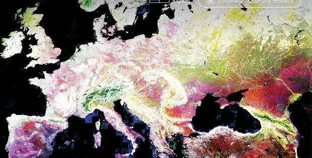
Cover Image: ESA